
OSINT: Challenge #001 - Gralhix
Table of Contents
Challenge Description
Source: https://gralhix.com/list-of-osint-exercises/osint-exercise-001/
The following image shows a screenshot of a Twitter post containing a photo.
Objectives:
- Find the coordinates where the photo was taken.
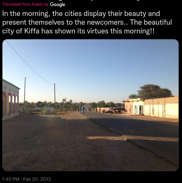
Click here for the photo without the Twitter border.
Solution
Initial Observations
Based on the original post, the following pivot points can be identified:
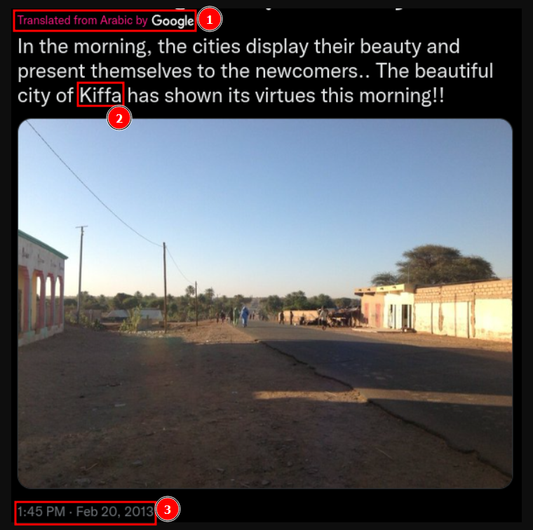
- P1: The original post was translated from Arabic.
- P2: The city of Kiffa is mentioned.
- P3: The post was published on February 20, 2013.
The post suggests that the photo was taken in Kiffa, a city in southern Mauritania. Additionally, the original post was translated from Arabic, and the image is presented with a sense of belonging, which suggests that the author may be from the area and may have been the person who took the photo.
Photo analysis.
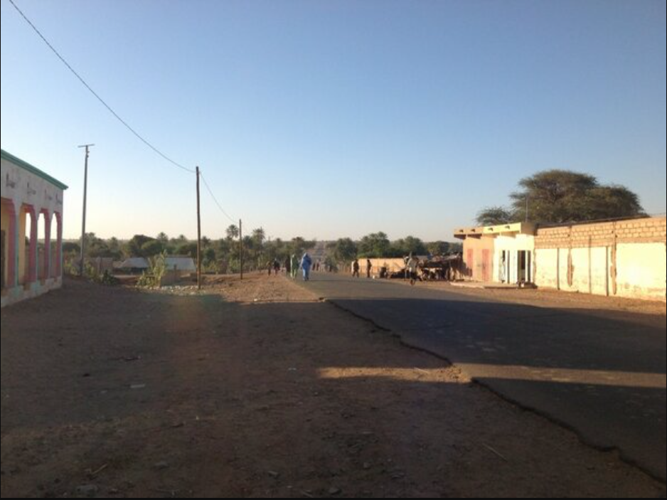
- Road: A paved road can be seen extending into the distance with a slight curve. It also appears to be a stretch of road leading out of the city.
- Buildings: Houses can be seen on both sides of the road. The one on the left is white with several columns, while on the right there are two buildings of different colors, along with a concrete wall.
- Vegetation: The terrain is flat, with reddish soil. The vegetation is mostly dry, although there are quite a few trees and areas of vegetation on both sides of the road.
- Utility poles: A row of three brown utility poles can be seen, along with another gray pole nearby.
Google Maps Search
By analyzing the aerial map of the city, four main roads leading out of the city can be identified and some of them have a higher concentration of vegetation than others.
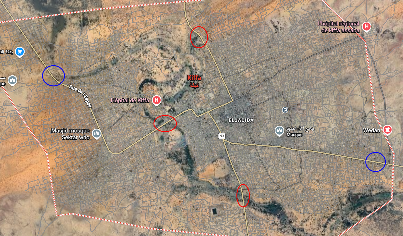
- The road in the middle has vegetation on both sides, but it is straight and located more centrally within the city, so it does not match the road shown in the photo.
- The upper road is located at the edge of the city, but it does not have the same curve or vegetation pattern as the road in the photo.
- The road at the bottom matches the photo because it has a slight curve to the right and has the most vegetation on both sides, making it the most likely option.
Looking more closely at the image, the similarities with the original photo become more apparent.
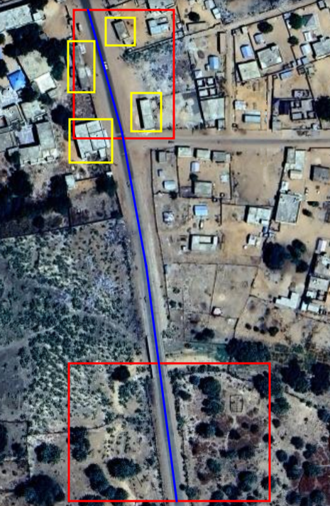
- The curved shape of the road and the vegetation match the original photo.
- The highlighted houses are potential landmarks that can help determine the exact location where the photo was taken.
The original image was taken around 2013, which means that the buildings may have changed considerably since then. By looking at image from around that year in Google Earth, clearer matches with the original photo can be found.
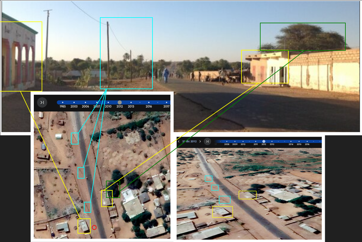
The coordinates where the photo was taken are: 16.609488, -11.397795.